Franklin Trail
Franklin Trail is a historical trail in Carpinteria. It closed back in the 1970s because ranchers worried people could carry avocado root rot to their crops. Through much work among government agencies, the Santa Barbara Land Trust and volunteers, they have reopened the trail.
The trail is divided into segments. These segments were called Phase I, II and III as the trail was being developed.
Phase I is 2.5 miles long and provides a decent route for some exercise. It is not terribly strenuous but it does have some steep uphill to get your heart pumping. The Phase I hike is about 5 miles round trip with an elevation gain of less than 800 ft. The top of the trail currently is just a little more than 850 ft.
Phase II is all along dirt roads for another 2.5 miles. There are several ups and downs along the road. The Phase II hike is about 10.5 miles round trip.
Phase III begins at the 5.2 mile mark and goes for another 3 or so miles. It is marked with a sign. It begins the true trail portion of the trail and travels steeply to the top of the mountain. The total round trip for the Phase III hike is approximately 16 miles.
At the summit of the Santa Ynez range, you can continue over the other side toward Jameson Reservoir on the Santa Ynez River. There is a small campsite on the other side about 2 miles or a little less than that down. The trail down the other side is sometimes called Alder Creek Trail. The trail is not well-maintained.
The trailhead is either on the bike path (there is a sign) at the end of Meadow View Lane or at the west end of the parking lot at the high school (there is another sign.)
This trail has three Phases.
Phase I
You can begin this trail by parking at the end of Meadow View Lane, or on weekends and when school or school events are not in session, at Carpinteria High School toward the west end of the parking lot in front.
From the Trailhead...
Follow the brown signs as you wind along side the high school and through the avocado orchards. You will be hemmed in by fencing on both sides.
After a bit you will emerge onto real trail without fencing. You really cannot get lost as the trail is marked well to keep you off private property.
Near the end there is a sign pointing the way to Franklin's bench. The trail proceeds beyond the bench on the dirt road you have been walking.
The current distance is 2.5 miles for a total of approximately 5 miles round trip. To get back to your car, return the way you came.
Phase II
Continue up the road beyond the bench. There will be another bench in about a mile. The route follows dirt roads for about 2.5 miles and goes up and down, but mostly up. Phase II ends at a sign that indicates the beginning of true trail. The sign says you have gone 5.2 miles. To return to your car now will give you a 10.2 mile round trip hike.
Phase III
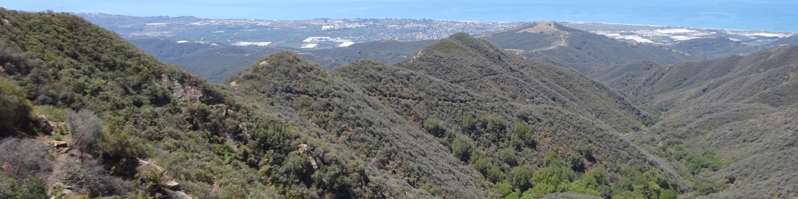
Phase III begins at the 5.2 mile mark at the sign and starts the true trail portion of the hike. The trail is steep and relentless. There are nice views. Portions of the original historical trail are apparent mid-way through as you can see reinforcement boulders lining the trail.
Near the top you will switchback until you emerge into a more sparsely vegetated area and then the trail becomes a little messy right at the very top where you emerge onto the dirt road. There are often motorcycles on the road.
If you return now, your total round trip is a little more than 16 miles.
The trail does continue down the other side. You can find the continuation pretty much directly across the road, although it is difficult to see immediately. This trail is in poor condition. There's a campsite by the creek in another mile and a half or so. This makes a pretty decent and strenuous backpack trip.